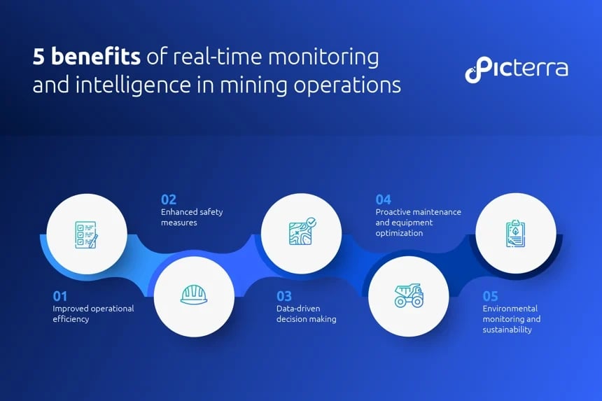
Prioritize the safety and well-being of your workforce and the communities surrounding your mining operations. Picterra’s geospatial analytics solutions allow you to proactively identify and mitigate safety hazards, reducing the risk of accidents and ensuring a secure working environment.
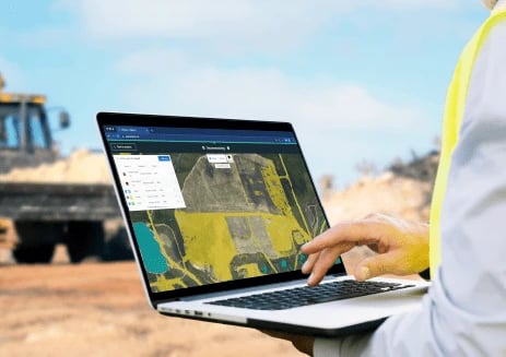
In the rapidly evolving landscape of mining digitalization, staying competitive and maximizing operational efficiency are paramount. Picterra's geospatial analytics solutions harness the power of AI and machine learning to optimize operations, streamline processes, and enable data-driven decision-making in real-time.
Picterra empowers you to monitor and reduce your environmental footprint, identify operational improvements, and maintain transparency in regulatory reporting. This facilitates the implementation of sustainable practices, harmonizing sustainability and profitability.
Exploration
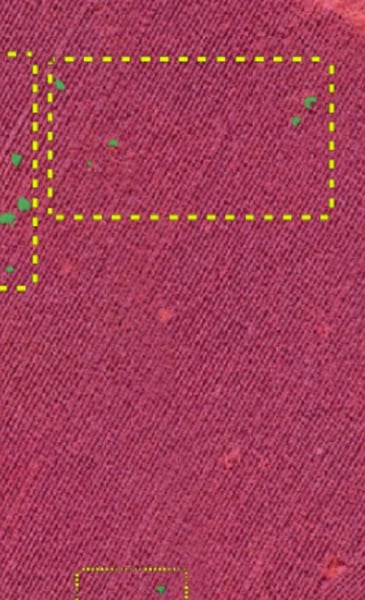
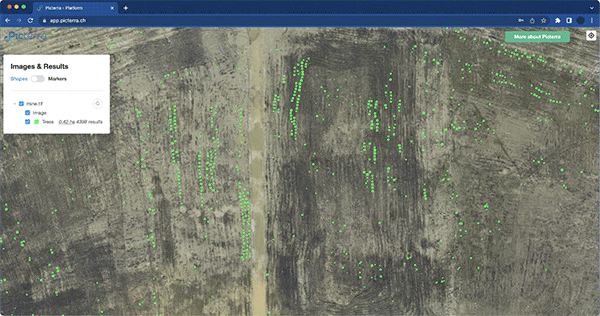
Efficiently assess new mine sites and identify mineral deposits using satellite imagery and Picterra's advanced algorithms. Our geospatial intelligence solutions enable mining companies to navigate exploration challenges, optimize resource identification, and make informed decisions while understanding the risks associated with new site exploration.
Planning and design
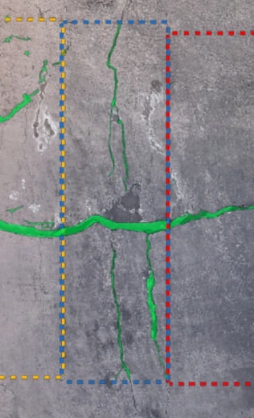
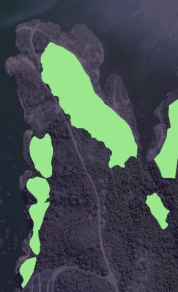
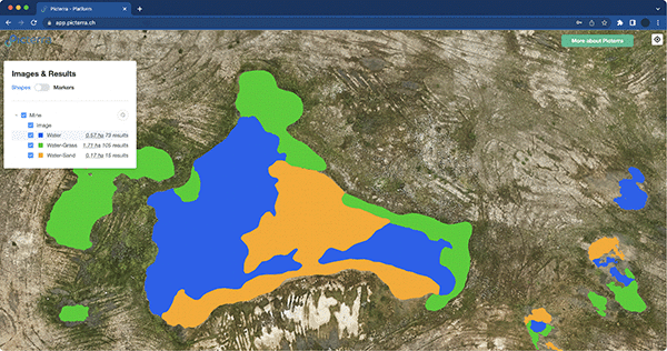
During the planning and design phase, Picterra's geospatial intelligence solutions help you streamline Environmental Impact Assessments (EIA) and optimize resource extraction planning. Leverage accurate baseline data, vegetation mapping, and biodiversity assessment to ensure compliance and design operations that minimize environmental impact and achieve sustainable and responsible mining practices.
Construction
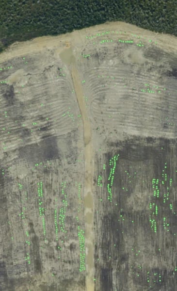
Geospatial intelligence plays a critical role in monitoring mine construction progress and minimizing risks during the construction phase. Picterra’s technology enables efficient documentation, compliance monitoring, and risk mitigation, ensuring timely project completion and adherence to regulations.
Production
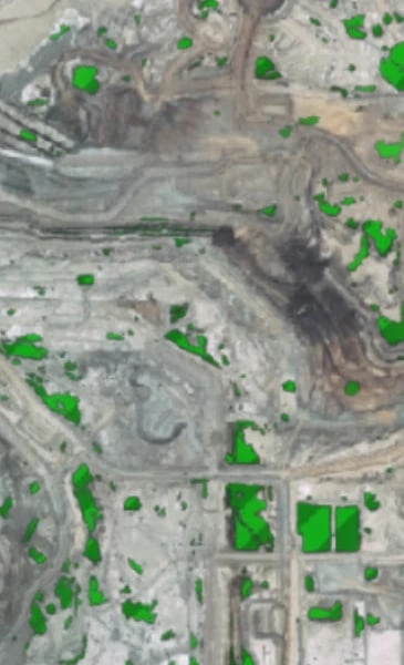
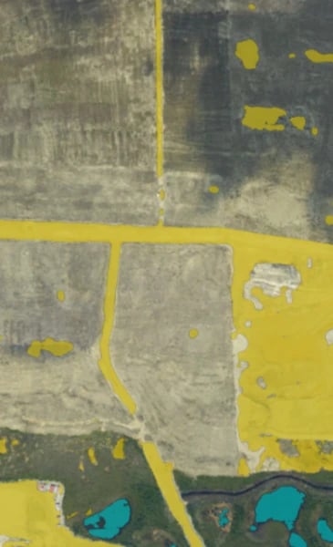
During the production phase, Picterra's solutions enable the identification of safety risks to protect the workforce and assets, ensuring a safe working environment. Additionally, geospatial analytics facilitate digital assets monitoring for predictive maintenance, volumetric measuring throughout the excavation process, and monitoring of mine waste and environmental impact.
Closure and reclamation
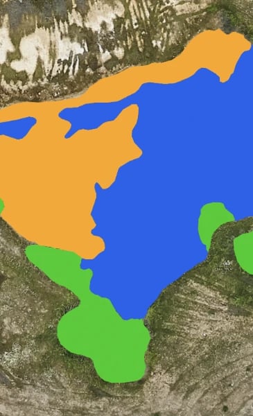
Picterra enables mining organizations to monitor and report on mine rehabilitation progress, track re-vegetation success, and detect invasive and indigenous species. This data-driven approach facilitates responsible mine closure and supports ongoing environmental stewardship.
Dive into an informative webinar that sheds light on how geospatial technology can help advancing the journey toward sustainable mining practices with Kenneth Davis, Programme Officer at the United Nations Environment Programme (UNEP) and Pierrick Poulenas, CEO Picterra

Discover real-world applications, case studies, whitepapers, and guides that provide
best practices and strategies to enhance operational efficiency, promote sustainability, and
maximize the value of your mining operations.
Mining sustainability: using geospatial data to reduce environmental footprint & mitigate risks